Local Maps
|

Wiltshire flag
|
Wessex flag
|
Kington St Michael
(approximately 101m above sea level)
To view a map of the village please click on the link below. Thank you.
Kington St Michael Village Map
Did you know that Wiltshire means "land where the willow trees grow"?
Public Rights of Way in Kington St Michael
(Last revised February 1996)
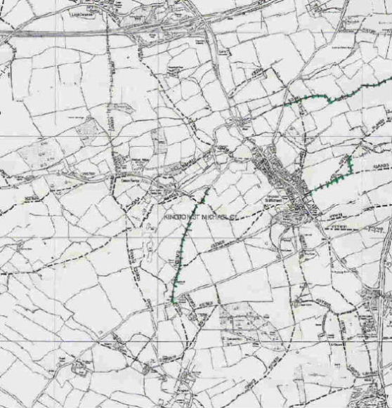
Key: Footpath -------- Bridleway l-l-l-l-l-l-
Here's a plain, easy to print map of the Public Rights of Way in the village.
To view a more detailed map of the parish, showing parish boundary, footpaths, etc please click on the link here  .
.
To view any public right of way in Wiltshire (including Kington St Michael's) please visit Wiltshire Council's website.
2008 Boundary Changes
The effect of the 2008 boundary changes on Kington St Michael is simply to straighten up the Northern Boundary. Five small parcels of land have swapped between our parish and either Grittleton or Stanton St Quintin. Please view the order here and view a map of the land area swapped here.
 |
 |
|
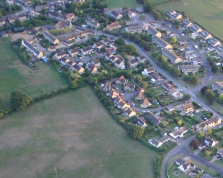
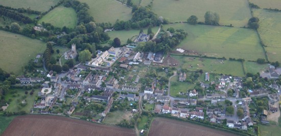
Aerial views of Kington St Michael, September 2005 (with thanks to Gerry Elms) |
Kington St Michael Ordnance Survey Map Information
|
|
|
Map Type |
Map Sheet Reference |
|
O.S. National Grid Reference |
ST 903772 |
|
O.S. 25 inch County Series 1870s-1940 |
20-May |
|
O.S. 6 inch County Series 1870s-1940 |
20 |
|
O.S. 1:2500 metric edition; 1950s onward |
ST 8877-8977; 9077-9177 |
|
O.S. 1:10000 metric edition; 1950s onward |
ST 87 NE; ST 97 NW |
|
O.S. Explorer |
156 |
|
O.S. Landranger |
173 |
|
Geological Sheet |
265 |
Adopted Roads
If you're as nerdy as our website administrator, you may be interested to read a list of Wiltshire's adopted roads! Those in Kington St Michael have been highlighted and can be found on pages 31, 33, 217. 227 & 228. The main road through the village is the C154.